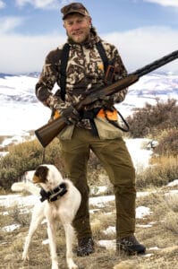
Have you ever wondered why some roads are closed, how a recreation area is developed for off-road vehicles, or what constitutes ‘multiple-use” on Bureau of Land Management (BLM) Lands? Jared Oakleaf, is a lifelong Lander citizen, outdoorsman, and the Outdoor Recreation Planner out of the Lander BLM Field Office recently us walked through the public planning process for the BLM.
At the beginning stages of BLM land management, there is a Resource Management Plan (RMP) that is established for a given region of BLM lands. This RMP is created through a public input process, so those interested in the land, wildlife, economic, and recreational values of an area can add their input to the process.
Jared uses an analogy of a house to illustrate the RMP. Different rooms, like segmented areas of BLM management, are given management priorities. One “room” that was established during the Lander RMP process was Johnny Behind the Rocks. It was established primarily as a Special Recreation Management Area. Doing so did not restrict all other uses on the land, but it limited them to other uses that did not directly undermine the primary management goal. At Johnny Behind The Rocks, you will still find cattle grazing there as a result. You will not find motorized traffic, however, to maintain the recreational values the public identified they wanted there.
Other rooms in this BLM “house” are given management priorities such as surface-level oil drilling, cattle grazing, off-road open play areas, and wildlife values. It is possible to have two or more of these activities in a single room in the house, but there are priorities given to the primary management goal – much like the dining room table can be used for playing cards after dinner.

These RMPs can set the stage for over 20 years of resource management on BLM lands. Jared says, “those resource management plans are very important for setting the trajectory of your favorite public land area long into the future.” He notes the Lander RMP that was in effect prior to June 2014 was established in 1987 – a time span of 27 years.
After establishing the activities for each area of a BLM management region, the local BLM office has a blueprint to then begin implementation planning. This includes establishing areas of environmental concern, as well as looking at best practices to make multiple uses happen in one area.
At every stage of this process, the BLM has field specialists analyzing the impacts of each use on the landscape and how it impacts the other uses. These environmental assessments done by field specialists inform the final actions that are taken at the ground level.
One of those final actions could be keeping a gate across a roadway until June 15 for wintering or calving wildlife. Then, once the gate is opened, it allows for other recreational uses of the landscape, like motorized vehicle use, for the other segment of the year. Another action would be to establish a parking area and trail maps, like Jared helped create for Johnny Behind The Rocks when it was created in 2014.
“The key all along is that folks have to be involved – they have to stay engaged. Otherwise, you can’t complain about what comes out the other end [of BLM land use planning],” Jared emphasizes.
As more BLM resource management plans come up for commenting and discussion, public needs to add their comments and make land values known about those places. Active participants give a voice to Wyoming’s wildlife, wild places, and recreational opportunities – all qualities cherished dearly on public lands.
This article is based on an Instagram Live interview with Jared Oakleaf on June 23, 2020.
